
Aerial Intelligence
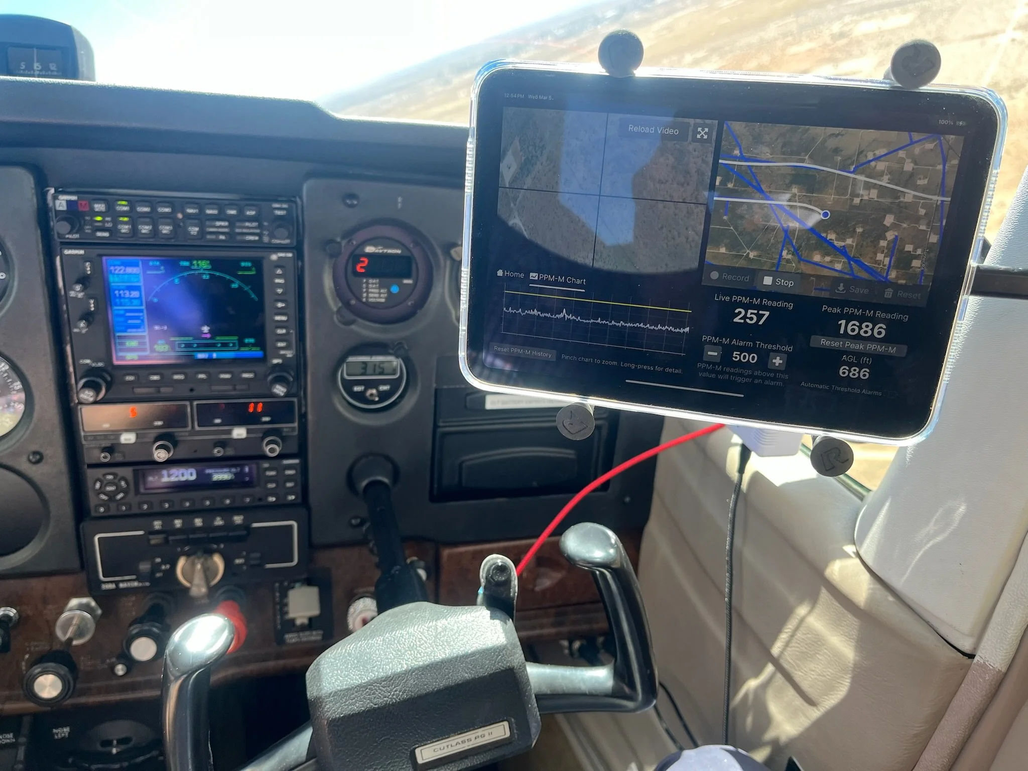
Methane Detection
Leveraging state‑of‑the‑art laser and infrared sensors, we pinpoint even the smallest methane leaks from the air. Our rapid, high‑resolution scans let you address issues before they escalate—reducing fugitive emissions, safeguarding the environment, and avoiding costly fines.
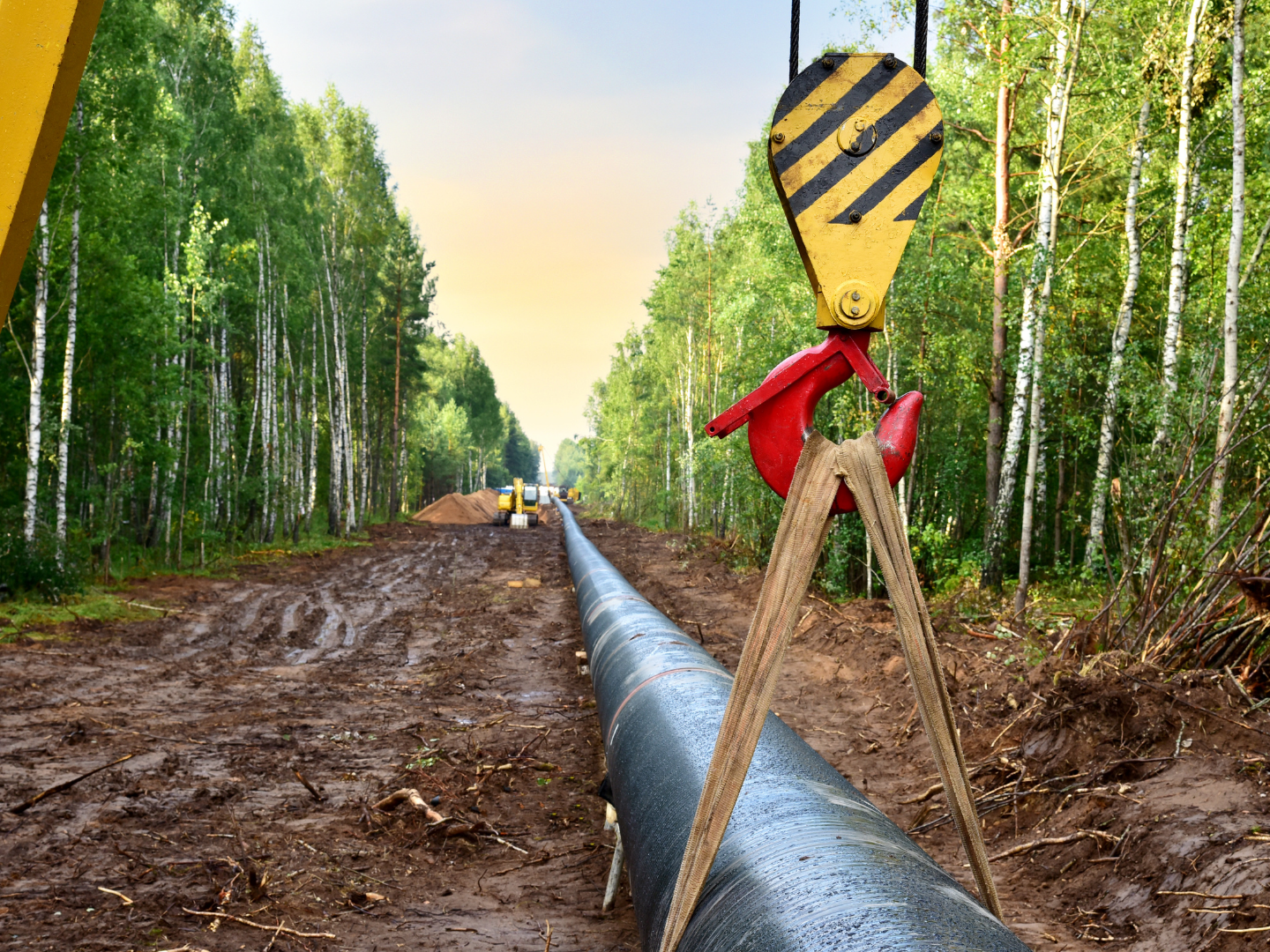
Pipeline reconnaissance
Our aerial teams fly precise corridor surveys to spot encroachments, erosion, or unauthorized activity along your pipeline routes. With geo‑tagged imaging and real‑time reporting, you gain the visibility you need to maintain safety, security, and regulatory compliance.

mapping and surveying
Using photogrammetry, we generate accurate maps and 3D terrain models. Whether you’re planning new infrastructure or monitoring site changes, our turnkey deliverables integrate seamlessly with your GIS and CAD platforms.